You are here
Climate Change and Drought Atlas launched
By Hana Namrouqa - Nov 23,2014 - Last updated at Nov 23,2014
AMMAN — Monthly, seasonal and annual precipitation maps for current and future scenarios indicate a general decrease in future precipitation, especially in rain-fed areas, according to the Climate Change and Drought Atlas for Jordan.
The highest drops in precipitation are expected in March, January and December in the northern areas, and in March and April in the southern region, the atlas revealed.
Launched by the International Centre for Agricultural Research in the Dry Area (ICARDA) on Sunday, the atlas also showed that the annual precipitation maps indicate a decline of 5-10 per cent in northern and western areas and 10-15 per cent in the southern areas.
Meanwhile, temperature maps for current and future scenarios indicate that both maximum and minimum temperatures will rise by 0.4-1.2°C across the country, mostly during summer and autumn.
On the impact of climate change and drought on the length of the growing period, the atlas indicated that most of Jordan is likely to experience moderate reductions of up to 15 days in some areas. The northern and central regions will have a more pronounced decrease, ranging from 15 to 30 days, but a few areas will face a decrease of more than 30 days.
The atlas provides background information of the expected threats, upon which technologies can be built to increase climate change adaptation measures, according to ICARDA, which said a similar atlas was prepared in Iraq last year.
ICARDA Director General Mahmoud Solh said the atlas is part of a project that focuses on a group of technologies that allow farmers and livestock producers to adapt to the negative implications of climate change in dry or very dry areas.
The focus is on the barley/livestock system where the effect of climate change in terms of low rainfall, drought and high temperatures is evident and has become a serious problem for farmers and residents of rural areas, Solh said, adding that this threatens the livelihood of communities and the food security of the country.
He noted that “the simple characterisation and downscaling methods used in the project confirm precipitation decline in most of the area, compounded by high temperatures and thus higher water demand for crops. In addition, we have shorter growing periods and shifts in climate zones.”
Solh underscored that the climate change atlas will be of a great use to farmers, researchers and policy makers and “support the agriculture sector, which not only enhances the economy but also has a big social and environmental impact that policy makers usually don’t take into consideration”.
Agriculture Minister Akef Zu’bi, who was presented with a copy of the atlas, said the publication is a “great tool” to measure the impact of climate change on rain-fed and arid lands.

Related Articles
Prime Minister Abdullah Ensour on Tuesday met with the director general of the International Centre for Agricultural Research in the Dry Areas (ICARDA), Mahmoud Solh, and discussed means to enhance joint cooperation.
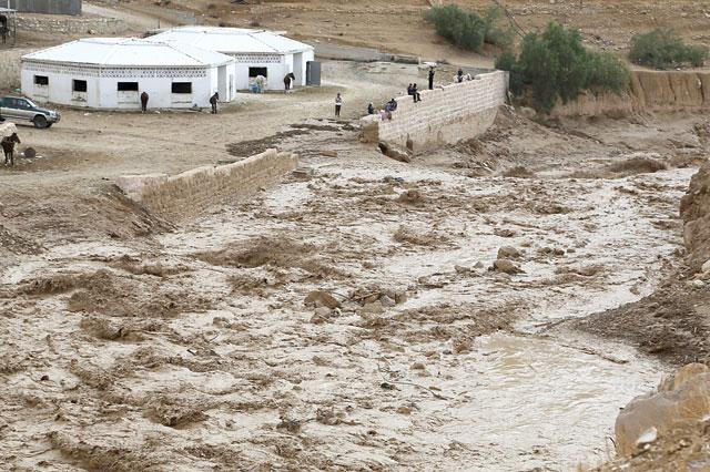
AMMAN — As Jordan was still licking its wounds after last month’s Dead Sea tragedy, flashfloods struck again this weekend, claiming new live
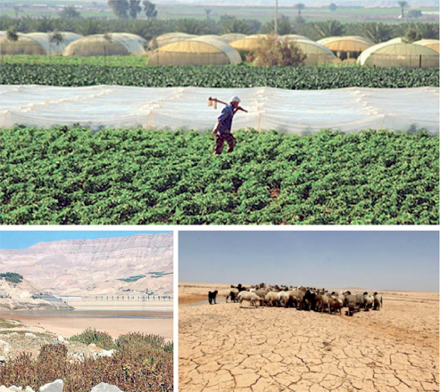
AMMAN — The temperature was 46°C degrees in Deir Alla’s Damia village in the Jordan Valley on August 28. Jamal Masalha sat near a fan to cool down, drinking a cold glass of water, but the veteran farmer was still frustrated, not only from the heat, but because he felt incapable of helping his plants withstand the scorching heat outside.

Opinion


- Popular
- Rated
- Commented
Apr 24, 2025
Apr 24, 2025

Apr 23, 2025

Newsletter
Get top stories and blog posts emailed to you each day.