You are here
Landslide closes Amman-Irbid road
By Dana Al Emam - Jan 24,2017 - Last updated at Jan 24,2017
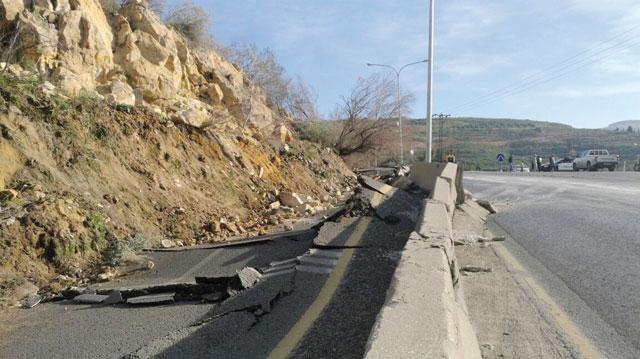
The landslide on the the road connecting Amman and Irbid forced the authorities to close the highway on Tuesday (Petra photo)
AMMAN — A landslide on the road connecting Amman and Irbid on Tuesday has resulted in the complete closure of the highway connecting the northern and central governorates, officials said.
The Public Security Department (PSD) announced the complete closure of the road connecting the two governorates from Nuaimeh Bridge (Arab Contractors), located south of Irbid, to the capital due to a major landslide in the Zarqa River area.
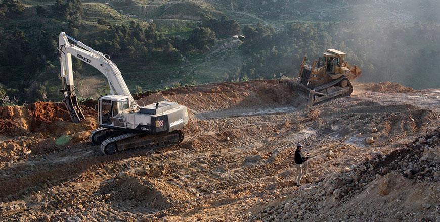
Visiting the site, Public Works and Housing Minister Sami Halaseh ordered opening a detour on the same road within 48 hours to facilitate the flow of traffic, the Jordan News Agency, Petra, reported.
In addition, the ministry will examine the cause of the landslide and will work on removing debris in order to re-open the road “as soon as possible”, he said.
Jerash Governor Qasim Mheidat said experts from the ministry have started a technical evaluation of the affected area, expecting the road to reopen within 30 days, weather permitting.
The reopening could be delayed further in case of rain or snow.
No injuries or damages were reported, Mheidat told The Jordan Times in a phone interview, adding that the only damage was to the road.
The Jordan Engineers Association said it dispatched a team to the site to inspect the damage to the road.
In a statement released Tuesday, the syndicate expressed its readiness to offer any assistance in assessing the damage, urging safety measures to prevent further rock slides.
Eye witnesses at the location said they had been expecting the collapse to happen for a long time, as private construction work at the top of the mountain had “weakened” the land mass and left holes in its structure.
They added that people who build large houses at the top of the mountains usually do not remove debris such as soil, bricks and concrete from building sites, which consequently fall off the mountain slope.
In addition, the area of the collapse was not covered with wire fence, which helps in preventing rock slides.
Mheidat described these claims as “inaccurate”, saying that construction debris could cause a minor collapse, not a landslide
He noted that the official technical report has not been finalised yet.
The mountain was nearly 250 metres wide and 60 metres high, according to Mheidat.
Nonetheless, he said the slide probably happened due to a lack of soil cohesion in the area, and it may have been weakened further during the last rainfall.
“Authorities are keeping an eye on other mountains in the area to prevent further landslides,” the official said.
He added that traffic was diverted in both directions so that those coming from Irbid to Amman can take the Irbid-Balaama-Zarqa road, while people driving from Jerash to Amman can take several subsidiary roads within the governorate.
Meanwhile, motorists coming from Amman to Jerash and Irbid can take detours in Mastaba (near Jerash) and Bireen, located to the northwest of Zarqa Governorate.
Raed Omari contributed to this report.

Related Articles
AMMAN — Jerash Public Works Director Akram Khasawneh on Thursday announced that traffic on the road connecting Amman and Irbid can now conti
AMMAN — The Ministry of Public Works and Housing on Tuesday said it has started the reconstruction work of the Jerash-Amman highway, where a
AMMAN — The partial collapse of a wall surrounding the yard of a 50-year-old house in Jabal Amman resulted in a rock slide, though without a

Opinion

Apr 26, 2024

Apr 26, 2024


Apr 25, 2024
- Popular
- Rated
- Commented
Apr 26, 2024
Apr 25, 2024
Apr 26, 2024


Newsletter
Get top stories and blog posts emailed to you each day.